Latest News, Scott Valley, Siskiyou

Klamath National Forest’s April snow levels highest in years

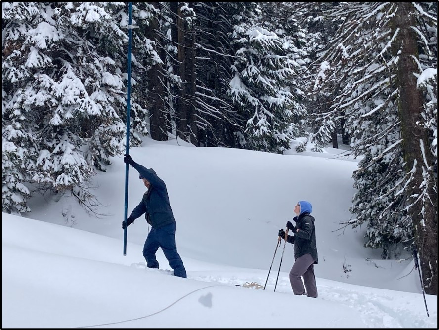
April 1st snow survey results for Scott River sub-basin

Forest Service News Release

Yreka, Calif., April 10, 2023—The Klamath National Forest has completed the April 1stsnow surveys. These measurements are a part of the statewide California Cooperative Snow Survey program, which helps the State forecast the quantity of water available for agriculture, power generation, recreation, and stream flow releases later in the year.

Winter continued strong all through March. There were many snowfall events; and when snow did fall, it stayed in place and helped build up the local snowpack. The end result is an amount of snow that hasn’t been seen in years and quite welcome after the lows of the previous year. According to measurements taken for the April survey, the snowpack is at 178% of the historic average snow height (snow depth) and at 163% of the historic Snow Water Equivalent (“SWE”, measure of water content) across all survey points (see results table).

The Box Camp site was unable to be surveyed this year. An attempt was made, but due to high snow load, the route proved to be overly technical and difficult for snowmobiles to access. However, even without the datapoint, it is clear that it would have joined the other sites as well above the long-term April average.

April 1st is an important date for surveying snow because early April is historically when the snowpack is at its maximum; and this date has the greatest weight when the State forecasts annual water availability. To gain additional data for April, three extra locations are added to the surveys for this month to supplement the usual five Scott River watershed snow measurement sites. Of these, Etna Mountain and Box Camp are also in the Scott River drainage, and Wolford Cabin is within the Trinity River basin. These additional sites are generally considered too remote or difficult to access on a monthly basis.

Snow surveys are conducted monthly during the winter and spring months (February through May). Forest Service employees travel to established sites in the headwaters of the Scott River watershed to take measurements. The newest measuring site at Scott Mountain has been monitored for over thirty-five years; the oldest site at Middle Boulder has been monitored for over seventy years. Some sites are located close to Forest roads with good access, while others require hours of travel by snowshoe and/or snowmobile.

The height of snow and SWE are measured by a snow sampling tube with a cutter end that is driven through the snowpack, measuring depth. The snow core is then weighed to determine the water content (SWE). The information is forwarded to the State of California, where the data is compiled with other snow depth reports and becomes part of the California Cooperative Snow Surveys program. The data is managed by the California Department of Water Resources; more information is available on their website at http://cdec.water.ca.gov/snow/current/snow/index.html.

Sampling at Etna Mountain site by Forest Service personnel Kip Van de Water 
and Anna Chinchilli using a long survey tube.
Credits: USDA Forest Service

Comments are closed.