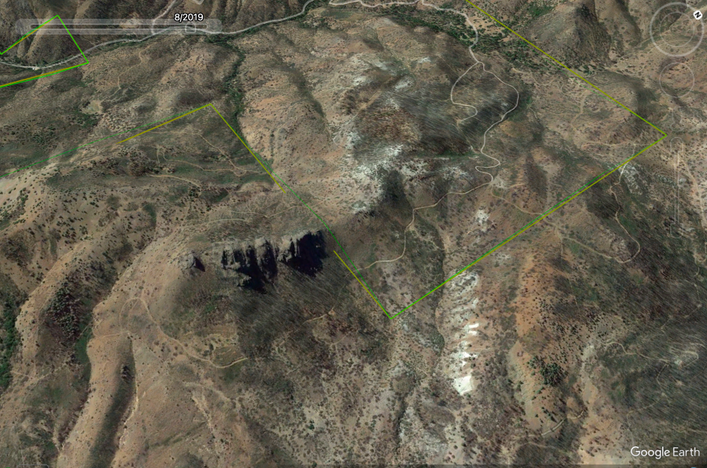
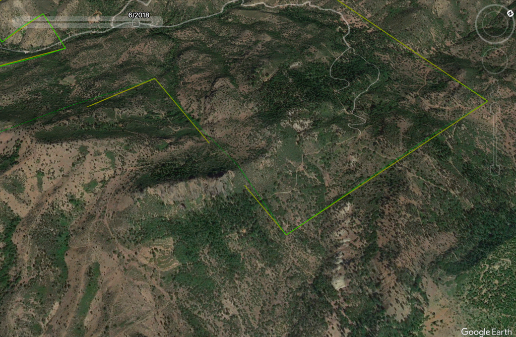
Centered in a seventeen-hundred-acre parcel of land east of Interstate 5 and just south of the California-Oregon border. On my travels up Copco Road just after Iron Gate Reservoir is a great vantage point for a picture with a long-distance lens.
41.969421, -122.542138
Siskiyou County, California
Took some research to find a name as it is not listed on topographical maps, but after finding a name I was able to find this from the Bureau of Land Management.
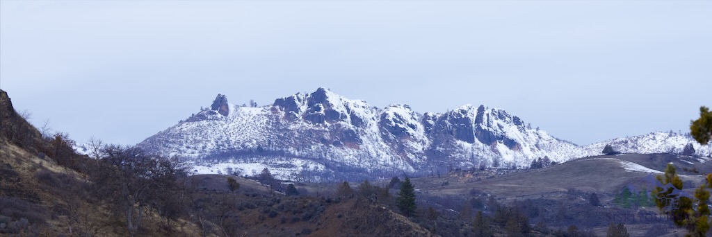
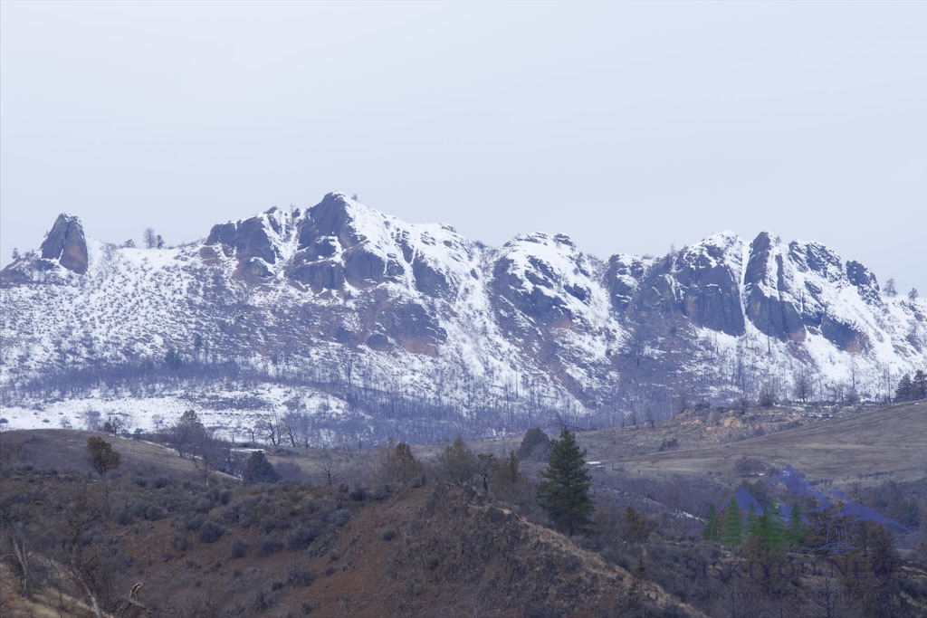
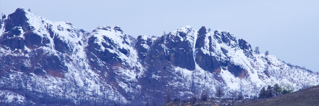
Little Pilot Rock
Geocache on Little Pilot Rock. The Omnibus Public Lands Management Act of 2009, Public Law No. 111-011, Section 1405, designated 24,100 acres of the Cascade-Siskiyou National Monument as wilderness. The Soda Mountain Wilderness encompasses the rich biological and geological diversity in the mountains southeast of Ashland, Oregon. The new wilderness lies on the south side of the Medford District. The heart of the wilderness is the 5,720-foot high Boccard Point where the great basin meets three mountain ranges. The older Klamath Range comes up from the south while the much younger Siskiyou Range extends from the west. Jutting up from the north is the very young Cascade Range.
www.blm.gov/or/resources
While searching google earth for the name I looked back through time and notice this area was burn in the Hornbrook fire in 2019.
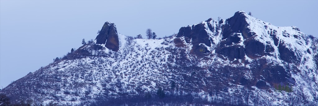
Here is some information about Pilot Rock which is very visible traveling on Interstate 5 at Hilt, California
Have something you wish to share with Siskiyou
send an email to the Publisher
Partner Ads By Google