Featured News, Scott Valley, Siskiyou

Snowpack across Klamath National Forest starts 2023 above historic averages 

February 1st snow survey results for Scott River sub-basin

Forest Service News Release

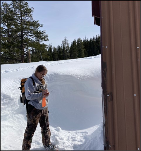
Scott Mountain snow station – Charnna Gilmore (volunteer) writing data on January 31, 2023.

Credit: USDA Forest Service

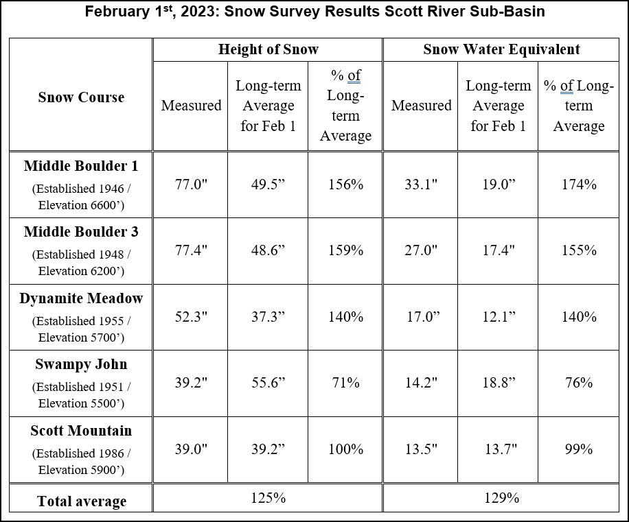
Yreka, Calif., February 8, 2023 – The Klamath National Forest has completed the February 1st snow surveys. These measurements are a part of the statewide California Cooperative Snow Survey program, which helps the State forecast the quantity of water available for agriculture, power generation, recreation, and stream flow releases later in the year.

The atmospheric river which started out the New Year brought a good amount of snow to much of the local high country around the Scott River Valley. Subsequent cooler temperatures have helped to maintain the snow despite mostly dry weather since mid-January. Consequently, the overall snowpack is above the long-term average for this time of year. According to measurements taken for the February survey, the snowpack is at 125% of the historic average snow height (snow depth) and at 129% of the historic average Snow Water Equivalent (SWE, a measure of water content) across all survey points (see result table). Historically, snowpack reaches its annual maximum by late-March/early-April. 

Snow surveys are conducted monthly during the winter and spring months (February through May). Forest Service employees travel to established sites in the headwaters of the Scott River watershed to take measurements. The newest measuring site at Scott Mountain has been monitored for over 35 years; the oldest site at Middle Boulder has been monitored for over 70 years. Some sites are located close to Forest roads with good access, while others require hours of travel by snowshoe and/or snowmobile.

The height of snow and SWE are measured by a snow sampling tube with a cutter end that is driven through the snowpack, measuring depth. The snow core is then weighed to determine the water content (SWE). The information is forwarded to the State of California, where the data is compiled with other snow depth reports and becomes part of the California Cooperative Snow Surveys program. The data is managed by the California Department of Water Resources; more information is available on their website at http://cdec.water.ca.gov/snow/current/snow/index.html.

Comments are closed.