Yreka, Calif., April 1, 2026 — The Klamath National Forest has completed the April 1 snow surveys. These measurements are a part of the statewide California Cooperative Snow Survey program, which helps the state forecast the quantity of water available for agriculture, power generation, recreation, and stream flow releases later in the year.

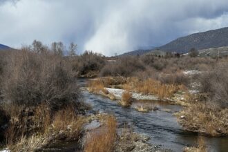
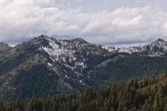
March is best described as a month featuring unseasonably warm and dry weather. Consequently, the meager snowpack of February became further diminished. Across all snow survey points, snow depth was at 1.8% of the long-term average for the time of year, while the Snow Water Equivalent (SWE) – a measure of water content – was at 1.5% the historical average. Current conditions are very similar to those measured in 2015 for the April survey, and to a lesser extent 2014 and 2022, all years with below average snowpack.
April 1 is a key date for surveying snowpack, as it often marks the seasonal peak and carries significant weight in the State’s annual water forecasting models. To capture additional data for this critical period, three extra locations are added to supplement the five standard Scott River snow measurement sites.
Snow surveys are conducted monthly during the winter and spring months (February through May). Forest Service employees travel to established sites in the headwaters of the Scott River watershed to take measurements. The newest measuring site at Scott Mountain has been monitored for forty years; the oldest site at Middle Boulder has been monitored for eighty years. Some sites are located close to Forest roads with good access, while others require hours of travel by snowshoe and/or snowmobile.
The height of snow and Snow Water Equivalent (“SWE”, measure of water content) are measured by a snow sampling tube with a cutter end that is driven through the snowpack, measuring depth. The snow core is then weighed to determine the water content (SWE). The information is forwarded to the State of California, where the data is compiled with other snow depth reports and becomes part of the California Cooperative Snow Surveys program. The data is managed by the California Department of Water Resources; more information is available on their website at https://cdec.water.ca.gov/snow.html.