Archived, Scott Valley, Siskiyou, South County, Yreka

Watching this Storm Develop 12.9

December 4th 2022

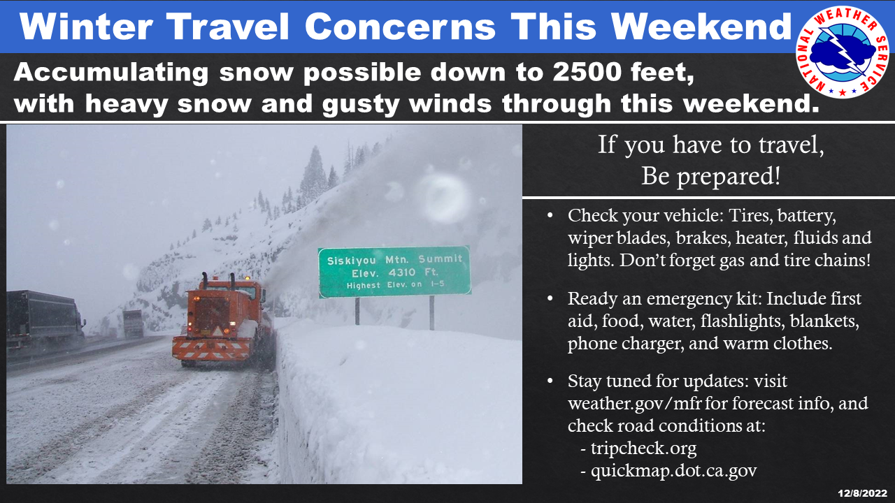
This storm has been building all week! Here is a few screen shots from satellite radar the green dashes indicate wind speed and wind pattern out in the Pacific Ocean.

***URGENT – WINTER WEATHER MESSAGE FOR CALLAHAN – ETNA AREA

Shasta Valley NWS REPORT

December 8th 2022
December 9th, 2022
December 9th, 2022 9am
www.weather.gov/mfr/

Today December 9th, 2022

A chance of snow before 1pm, then a chance of rain and snow. Cloudy, with a high near 40. South southeast wind 7 to 17 mph, with gusts as high as 26 mph. Chance of precipitation is 30%. Total daytime snow accumulation of less than a half inch possible. 

Tonight

Snow. Snow level 3100 feet. Steady temperature around 38. Breezy, with a south southeast wind 25 to 29 mph, with gusts as high as 44 mph. Chance of precipitation is 100%. New snow accumulation of less than a half inch possible. 

Saturday

Snow before 10am, then rain and snow. Snow level 4000 feet. Steady temperature around 36. South wind 11 to 17 mph, with gusts as high as 26 mph. Chance of precipitation is 100%. Little or no snow accumulation expected. 

Saturday Night

Rain and snow showers. Snow level 3600 feet lowering to 3100 feet after midnight . Low around 30. Southwest wind around 5 mph becoming calm in the evening. Chance of precipitation is 80%. New snow accumulation of less than one inch possible. 

Sunday

A 50 percent chance of snow showers, mainly before 4pm. Mostly cloudy, with a high near 36. Calm wind becoming west around 5 mph in the afternoon. New snow accumulation of less than a half inch possible. 

Sunday Night

A 20 percent chance of snow showers before 10pm. Mostly cloudy, with a low around 24.

Comments are closed.