One Town, Two Poles, and a Longstanding Local Secret

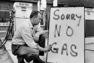
WEED, Calif. — In the shadow of Mount Shasta, Weed, California—a small town in Siskiyou County known for its lumber history and strategic location—harbors a historical puzzle involving two totem poles. One stands prominently in the parking lot of Ray’s Food Place, where it has drawn attention from passersby for over 60 years. The other, an authentic artifact from 1922, disappeared from public view decades ago and was last reported in 1995 to be preserved in a private residence in southern Siskiyou County. This distinction between the two poles, often overlooked, reveals a layered story of local promotion, cultural symbols, and preservation.
The Original Pole: An Authentic Marker from 1922
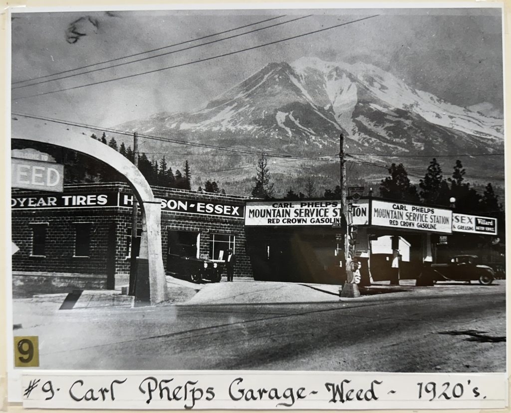
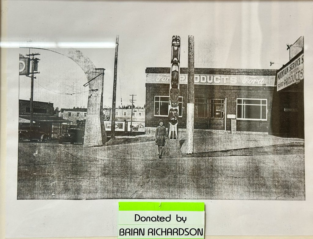
The story begins in the early 1920s, when Weed businessman Carl R. Phelps purchased a hand-carved totem pole by Alaskan Indigenous artisans during a visit to Seattle. Phelps shipped the pole to Weed and installed it at his Mountain Service Station, located at the southeast corner of Weed Boulevard and Main Street. The pole served as a promotional landmark, designating Weed as the “Gateway to Alaska” and highlighting the town’s position at the start of the unfinished road that would become U.S. Highway 97 in 1930.

This authentic totem endured significant challenges, surviving two fires—one in 1926 and another in 1927—that damaged the surrounding station. It remained a visible icon through the mid-20th century, appearing in postcards and attracting tourists. However, by the early 1960s, as the area developed, the pole was removed and stored in a shed near the site of the current Pizza Factory.
In the 1960s, Jimmy Culley, an employee at Long Bell Lumber and an antique enthusiast, rediscovered the pole and restored it, reviving its original colors and designs. The restored artifact was then sold at a rummage sale on Park Street in 1967 to anonymous buyers.
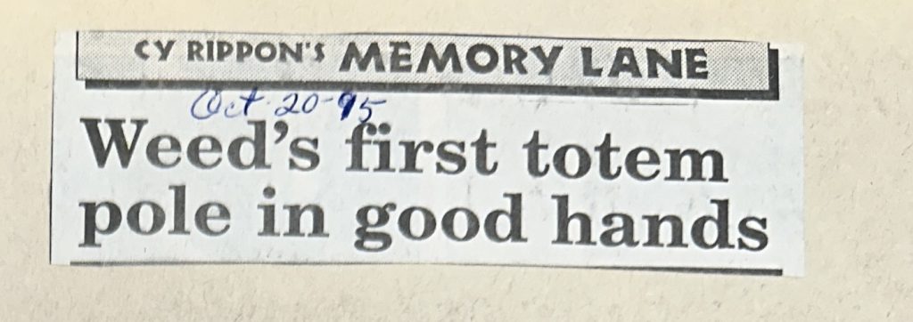
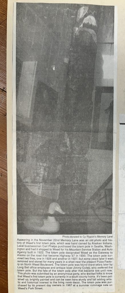
For nearly three decades, its whereabouts were unknown, leading many to assume it was lost. That changed on November 22, 1995, when local historian Cy Rippon published details in his “Memory Lane” column in the Weed Press. Based on an anonymous submission, Rippon revealed that the pole was in a private home in southern Siskiyou County, described as “polished up, brightly painted and… adding artistic and historical interest to the living room decor.”
As of 2025, no further public updates have emerged regarding its location or condition. The anonymity surrounding its current owners may stem from a desire to protect privacy, given the cultural sensitivity of Indigenous artifacts and their potential value.
The 1962 Replica: A Commercial Landmark
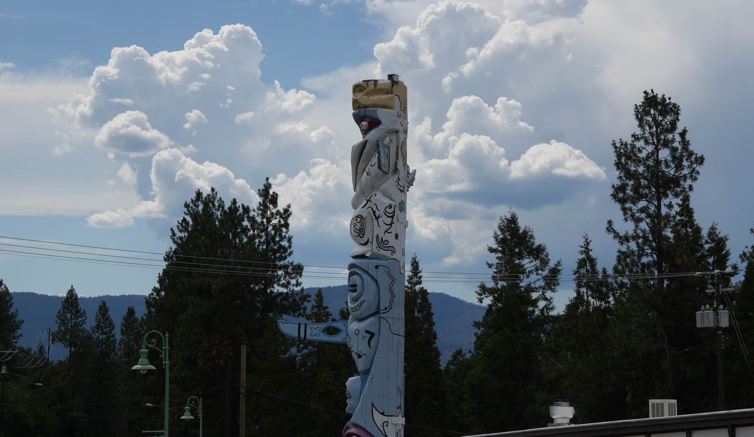
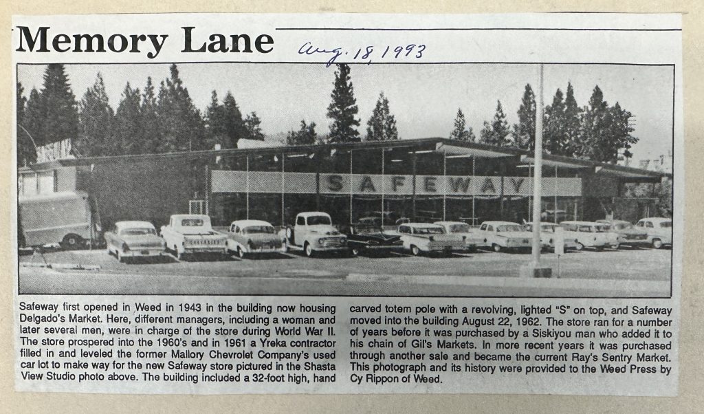
The pole visible today in the Ray’s Food Place parking lot is a separate creation, commissioned in 1962 for the opening of a new Safeway store at the junction of Highways 99 and 97. To attract customers and evoke Weed’s Alaskan theme, Safeway hired Barney West (1919–1981), a Seattle native who moved to the Bay Area as a child and became known for his tiki and totem carvings. West, who operated an outdoor studio called Tiki Junction in Sausalito starting in 1958, carved the 32-foot pole from a California redwood log sourced from the Santa Cruz Mountains. The process took two to three months, incorporating designs inspired by Alaskan originals.
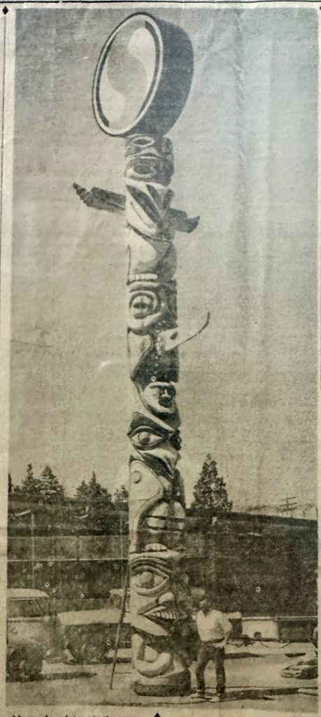
Topped with a revolving, lighted red “S” in a white circle—Safeway’s logo—the pole was installed in the parking lot and praised in local newspapers as an “attention-getting” feature visible from the highways. It aimed to draw tourists for photographs against the backdrop of Mount Shasta.
The store changed hands over the years, becoming Gil’s Markets, then Ray’s Sentry Market, and eventually Ray’s Food Place. The revolving “S” was removed after Safeway’s departure, and the pole withstood a severe winter storm on December 5, 1987, which featured 100-mph gusts that damaged the store’s windows but left the structure intact. Today, the pole remains in place, though showing signs of weathering and is protected by barriers to prevent vehicle damage.
The Alaska Highway Connection
Both poles tied into Weed’s promotion as the southern starting point for travel to Alaska, a concept rooted in the town’s location at the southern end of U.S. Route 97. This 663-mile highway extends north through Oregon and Washington to the Canadian border, where it connects to British Columbia Highway 97. The final 600 miles of BC Highway 97 form part of the Alaska-Canada Highway (ALCAN), a 1,387-mile route from Dawson Creek, British Columbia, to Delta Junction, Alaska.
The ALCAN was constructed in 1942 as a wartime necessity following the Pearl Harbor attack, completed in just eight months by 11,000 soldiers and 16,000 civilians at a cost of $185 million (equivalent to about $2.9 billion today). It addressed engineering challenges like permafrost and muskeg terrain, serving as a defense supply line. A 1964 proposal to extend U.S. 97 all the way to Alaska was approved but withdrawn in 1968 due to Yukon’s refusal to renumber its section.
Weed’s boosters in the 1920s anticipated this northern linkage, using the totem poles to emphasize the town’s role in the highway system that links California to Alaska’s frontier.
An Ongoing Historical Puzzle
The two poles represent contrasting paths: the 1962 replica as a public, commercial symbol exposed to the elements, and the 1922 original as a preserved cultural artifact in private hands. While the visible pole continues to attract visitors unaware of its replica status, the original’s fate remains Siskiyou County’s enduring secret.

Local historians and residents speculate that the discretion protects the pole’s cultural significance, especially amid growing awareness of Indigenous heritage. Whispers of a matching totem at the northern end of Highway 97, such as at Biggs Junction where it meets the Columbia River, persist as unconfirmed folklore.
If new information about the original pole emerges, it could provide closure to this chapter of Weed’s history. For now, the mystery endures, a testament to the town’s layered past at the crossroads of northern routes.
Sources include historical clippings from the Weed Historic Lumber Town Museum, Cy Rippon’s “Memory Lane” articles, and local archives.