Scott Valley

Winter storm impacts snow surveys: March 1st snow survey results for Scott River sub-basin

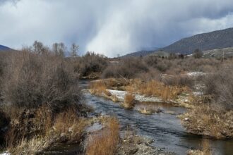
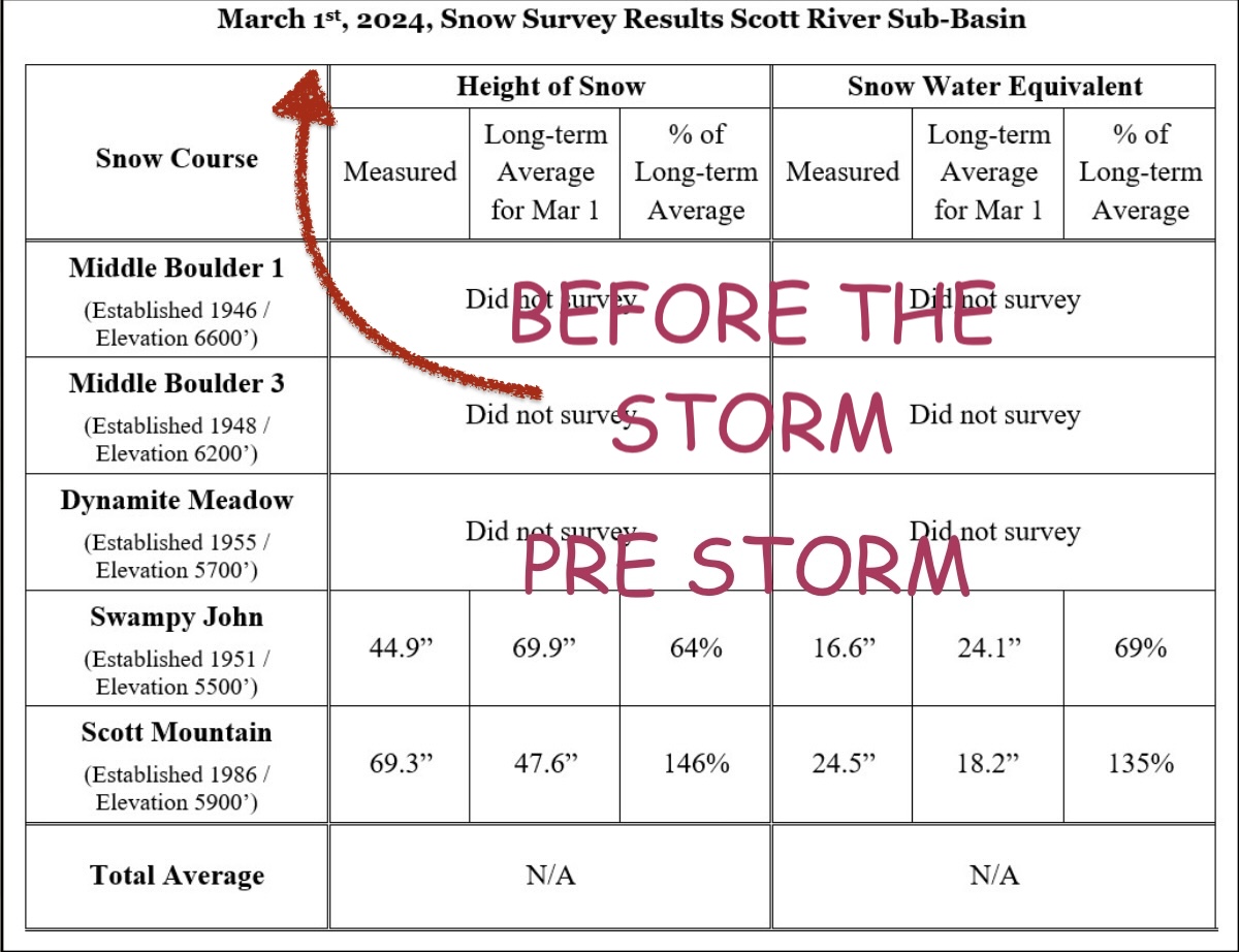
PUBLISHERS NOTE: Thanks to an observant farmer, this data is from before this last set of storms that stormed from March 2nd thru 5th. According to NOAA Drought.gov Siskiyou county is 2.52 inches above normal or 30th wettest January on record in over the past 130 years. But California sees this as 29.80% abnormally dry.

KNF Press Release

Yreka, Calif., March 6, 2024— The Klamath National Forest has completed the March 1stsnow surveys. These measurements are a part of the statewide California Cooperative Snow Survey program, which helps the state forecast the quantity of water available for agriculture, power generation, recreation, and stream flow releases later in the year.

The weather for February was variable. The occasional precipitation observed periods of rain, including snow at higher elevations. However, there were also many nice days, with temperatures on the valley floor mild and spring-like. The storm at the end of February undoubtedly added to the local snowpack. Unfortunately, the storm also created safety and access issues for surveyors; and, in addition to scheduling conflicts and other reasons, three sites – Dynamite Meadow, Middle Boulder 1, Middle Boulder 3 – were unable to be visited. Preparations for surveying were made but were not able to be acted upon. Measurements at the two sites which were visited suggest the snow received prior to the storm at the end of the February was variably distributed around the valley. Historically, snowpack reaches its annual maximum by late-March/early-April.

Charnna Gilmore (left; Scott River Watershed Council; volunteer) and Kip Van de Water (right; Forest Service) survey snow depth at the Swampy John site, below Etna Summit. Credit: USDA Forest Service

Snow surveys are conducted monthly during the winter and spring months (February through May). Forest Service employees travel to established sites in the headwaters of the Scott River watershed to take measurements. The newest measuring site at Scott Mountain has been monitored for over 35 years; the oldest site at Middle Boulder has been monitored for over 70 years. Some sites are located close to forest roads with good access, while others require hours of travel by snowshoe and/or snowmobile.

The height of snow and Snow Water Equivalent (“SWE”, measure of water content) are measured by a snow sampling tube with a cutter end that is driven through the snowpack, measuring depth. The snow core is then weighed to determine the water content (SWE). The information is forwarded to the State of California, where the data is compiled with other snow depth reports and becomes part of the California Cooperative Snow Surveys program. The data is managed by the California Department of Water Resources; more information is available on their website at http://cdec.water.ca.gov/snow/current/snow/index.html.


Leave a Comment

Your email address will not be published. Required fields are marked *

*